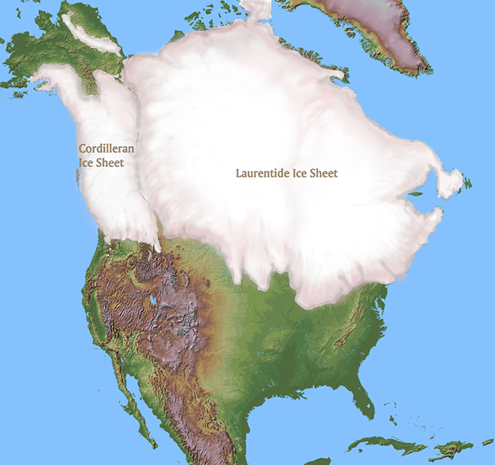
The great glacier complex over North America during the late Wisconsin consisted of two separate ice sheets. The larger actually formed as two separate nuclei—one to the east and the other to the west of Hudson Bay. These two centers of glacial accumulation coalesced to become the Laurentide Ice Sheet. To the west, over the Canadian Rockies, a second great ice sheet began to form. Eventually, the two ice sheets met in the western prairies of Alberta, within view of the eastern front of the Rockies. The area between the ice sheets has come to be called the ice free corridor. The extent and timing of the corridor are still being worked out. It is probable that it was utilized by both animals and humans in their migrations. It is generally believed that this provided the primary corridor for the arrival of humans into North America from Siberia, across the exposed Bering Land Bridge. It is likely that there were, in fact, multiple routes into the continent. It now appears increasingly likely that humans occupied North America before the last glacial expansion of the late Wisconsin Ice Age, ca 20 to 25 thousand years before present, in which case the much diminished ice would not have acted as an impassable barrier. The corridor, such as it was, came into existence towards the end of the late Wisconsin and could have served to accommodate two-way traffic.